Coregistration of Satellite Image Time Series Through Alignment of Road Networks
Abstract
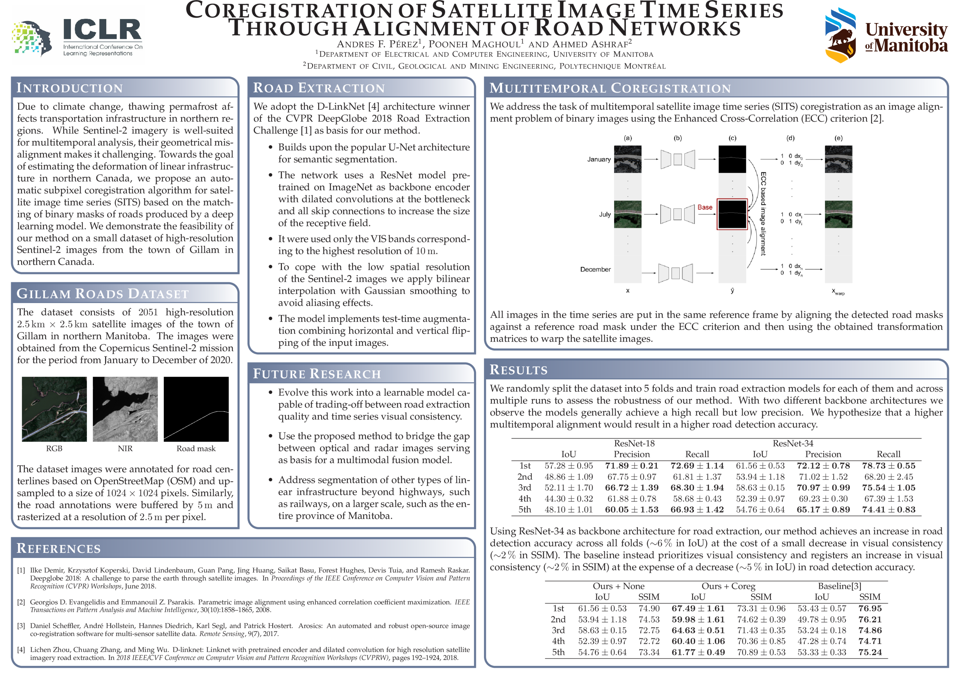
Due to climate change, thawing permafrost affects transportation infrastructure in northern regions. Tracking deformations over time of these structures can allow identifying the most vulnerable sections to permafrost degradation and implement climate adaptation strategies. The Sentinel-2 mission provides data well-suited for multitemporal analysis due to its high temporal resolution and multispectral coverage. However, the geometrical misalignment of Sentinel-2 imagery makes this analysis challenging. Towards the goal of estimating the deformation of linear infrastructure in northern Canada, we propose an automatic subpixel coregistration algorithm for satellite image time series based on the matching of binary masks of roads produced by a deep learning model. We demonstrate the feasibility of achieving subpixel coregistration through alignment of roads on a small dataset of high-resolution Sentinel-2 images from the region of Gillam in northern Canada. This is the first step towards training a road deformation prediction model.