SEA LEVEL PROJECTIONS WITH MACHINE LEARNING USING ALTIMETRY AND CLIMATE MODEL ENSEMBLES
Abstract
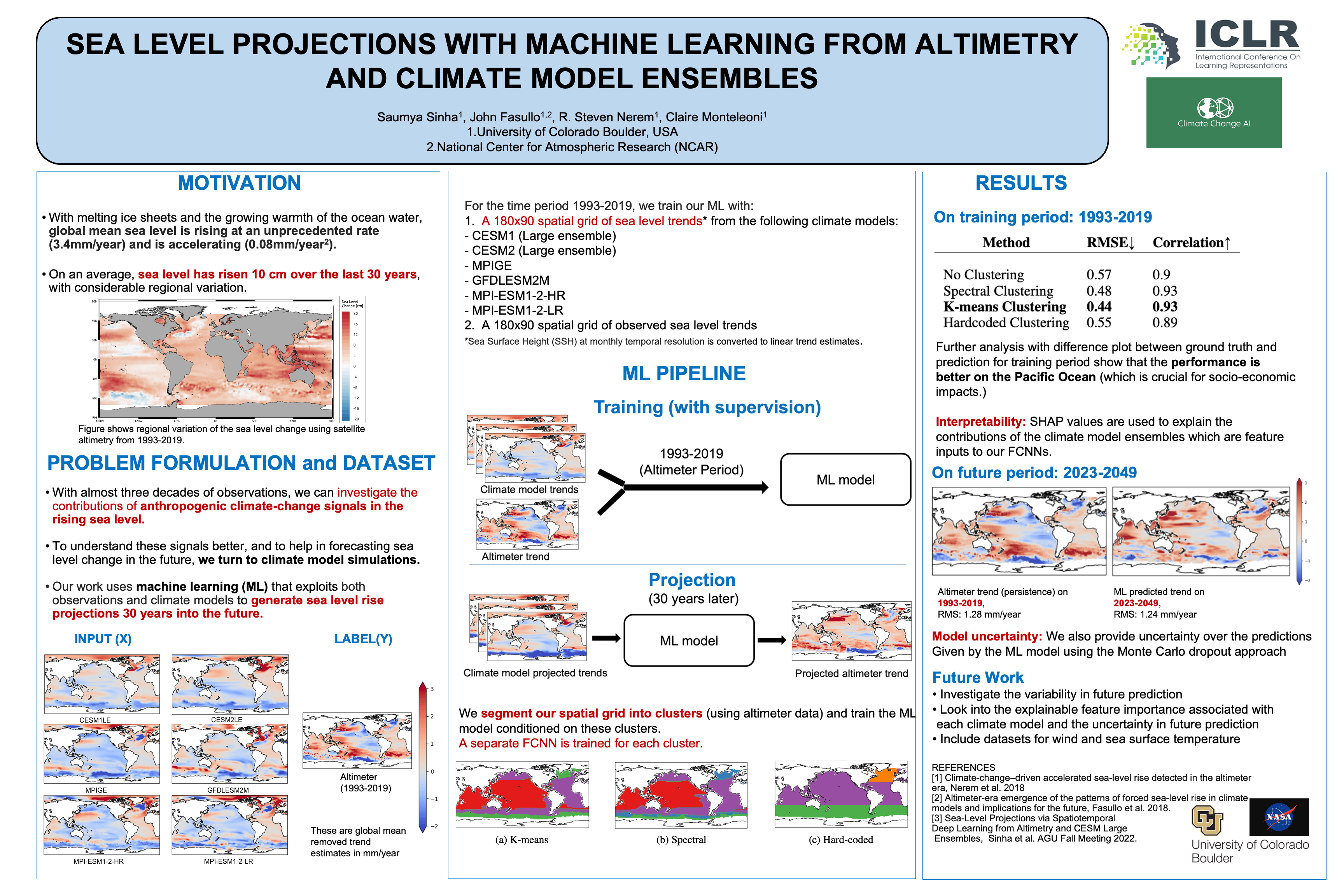
Satellite altimeter observations retrieved since 1993 show that the global mean sea level is rising at an unprecedented rate (3.4mm/year). With almost three decades of observations, we can now investigate the contributions of anthropogenic climate-change signals such as greenhouse gases, aerosols, and biomass burning in this rising sea level. We use machine learning (ML) to investigate future patterns of sea level change. To understand the extent of contributions from the climate-change signals, and to help in forecasting sea level change in the future, we turn to climate model simulations. This work presents a machine learning framework that exploits both satellite observations and climate model simulations to generate sea level rise projections at a 2-degree resolution spatial grid, 30 years into the future. We train fully connected neural networks (FCNNs) to predict altimeter values through a non-linear fusion of the climate model hindcasts (for 1993-2019). The learned FCNNs are then applied to future climate model projections to predict future sea level patterns. We propose segmenting our spatial dataset into meaningful clusters and show that spectral clustering helps to improve predictions of our ML model.