Bird Distribution Modelling using Remote Sensing and Citizen Science data
Abstract
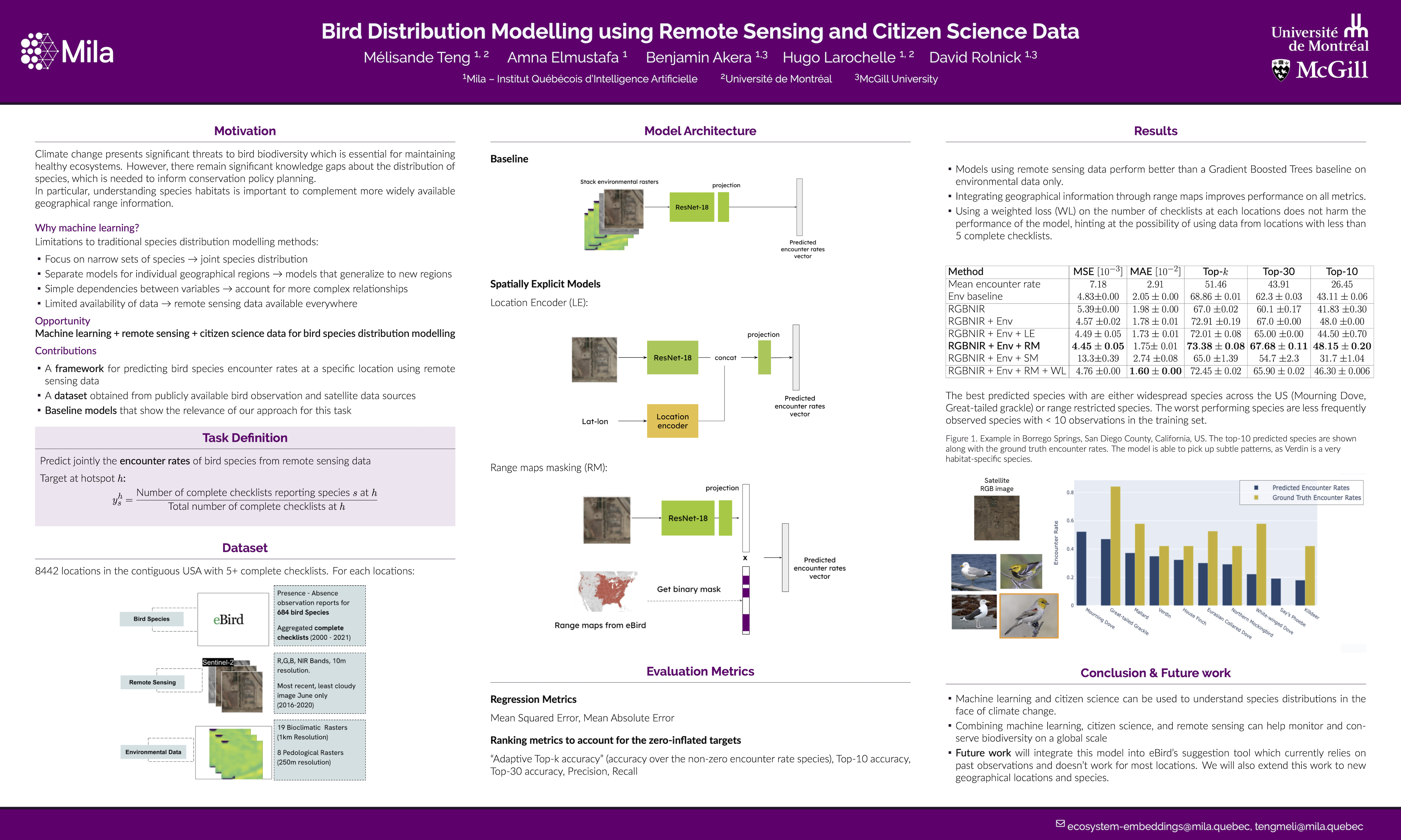
Climate change is a major driver of biodiversity loss, changing the geographicrange and abundance of many species. However, there remain significant knowl-edge gaps about the distribution of species, due principally to the amount of effortand expertise required for traditional field monitoring. We propose an approachleveraging computer vision to improve species distribution modelling, combiningthe wide availability of remote sensing data with sparse on-ground citizen sciencedata from .We introduce a novel task and dataset for mapping US bird species totheir habitats by predicting species encounter rates from satellite images, alongwith baseline models which demonstrate the power of our approach. Our methodsopen up possibilities for scalably modelling ecosystems properties worldwide.